Op-Ed: 'Seattle Atlas' Can Demystify Zoning, Build Case for More Housing
Have you ever found yourself in a conversation with someone who wants Seattle to be affordable, safe, and vibrant but, in the same breath, claims they don't want "apartments near their house" or "the character of their neighborhood ruined?" I have. And every time, I wish I could show them the reality of Seattle zoning: the real progress that has been made and the existing uphill battle for builders trying to add more housing, and vibrancy along with it, to Seattle.
Google's Project Sunroof empowered homeowners to see the potential cost savings solar could have on their roof using satellite data. Lachlan Campbell's American Toxics mapped Superfund sites across the country, allowing users to see if a toxic site is near their home, school, or workplace. Both work because they make visible the built landscape, and its immediate impacts on one's life; if policy is made visible, it becomes accessible.
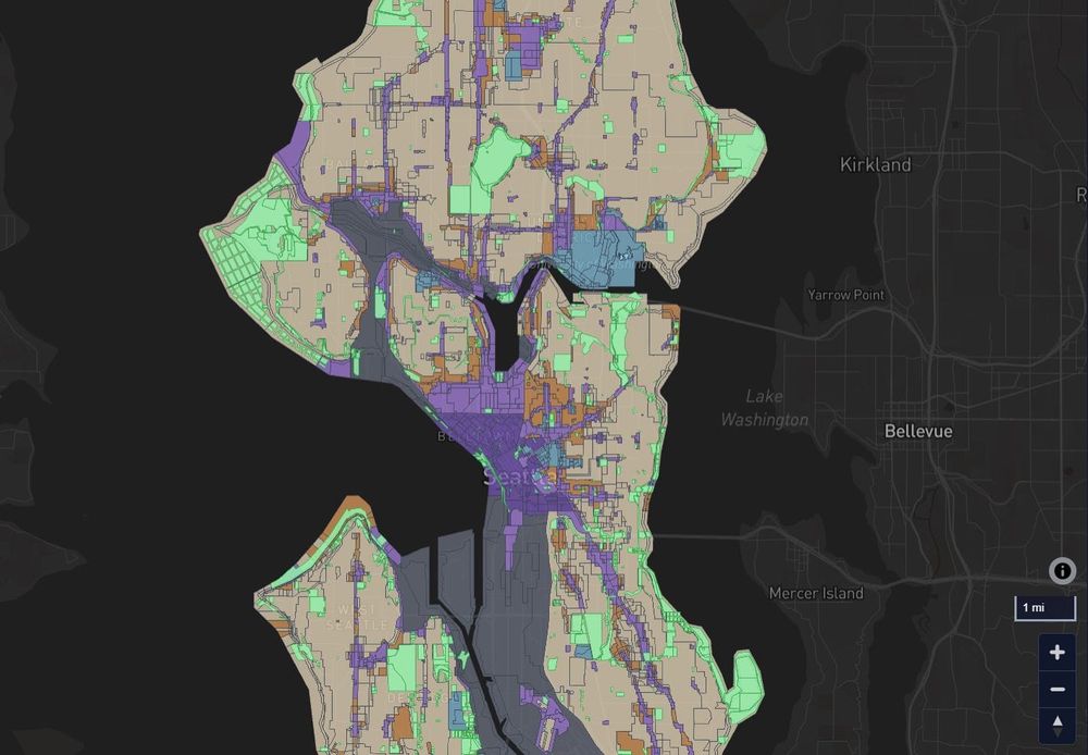
To close this gap – to make visible Seattle’s urban policy – I created Seattle Atlas, an interactive map that lets users see zoning, transit infrastructure, and bike lanes, so Seattleites can see for themselves what our city is doing well and where we are lacking.
The site starts with a full map of Seattle in a simplified zoning view. It translates Seattle's dozens of complex zoning codes into categories anyone can read: Homes & Small Shops, Midsize Residential and Shops, Large Buildings, Downtown & Highrise, Institutions, Industrial, and Parks. You can understand it, your friends can understand it; even your uncle who hates that new apartment building near him can understand it. And when you see Seattle's zoning on a map, one category dominates the picture.
https://www.theurbanist.org/op-ed-seattle-atlas-can-demystify-zoning-build-case-for-more-housing/