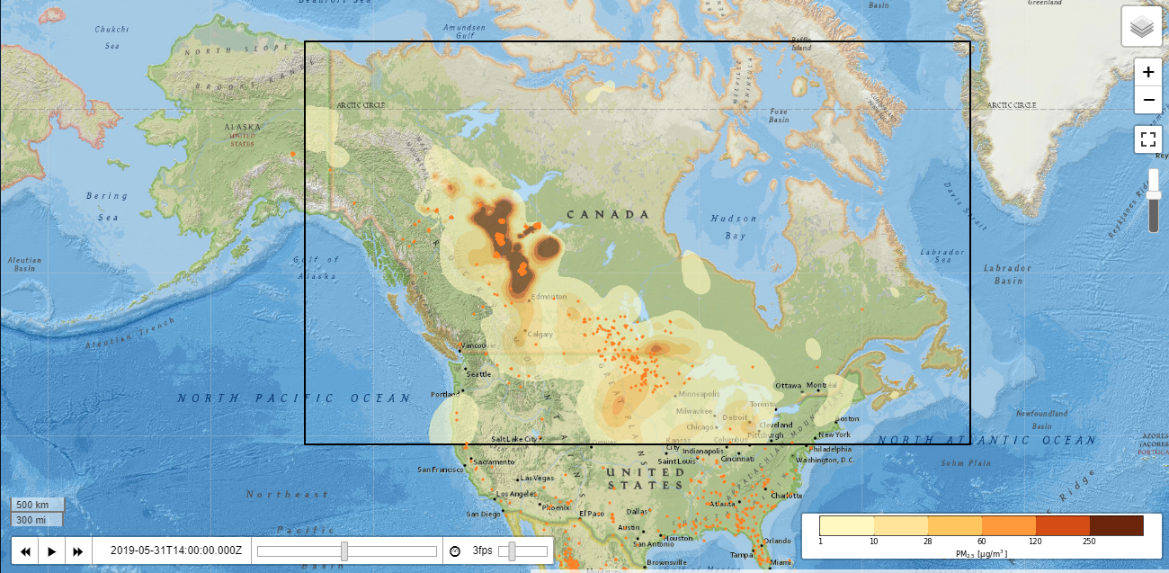
Where there's smoke, there's one of Canada's largest fires

This smoke map, provided by the Canadian Parks Agency, shows the rough extent and intensity of smoke cover generated by the Alberta wildfires and other smaller fires throughout the northern U.S. and Canada.
If you smell wood smoke or see haze in the sky the next few days, it may not be from your neighbor’s cookout. It might be from a wildfire in Canada.
Earlier in May, wildfire officials in Canada’s central Alberta province noticed the first signs of a blaze moving through the province’s northern forests.
“Some of the fires kicking up smoke right now have been burning since May 12,” Derek Gagnon, a Provincial Information Officer for the Alberta Wildfire Center, said. “One of the biggest fires has been burning since May 18.”
By Thursday, May 30, fires had enveloped large areas of those local forests, with the biggest blaze spreading over 230,000 hectares — more than 888 square miles. “That easily puts it in the top ten [largest fires] of Alberta’s recorded history,” Gagnon said.
Read more:
https://www.capjournal.com/news/where-there-s-smoke-there-s-one-of-canada-s/article_eb8bea9e-8327-11e9-a045-5fff6b0b81e8.html
