Anthropology
Related: About this forumLidar Reveals Sacred Roads Near Chaco Canyon
February 26, 2025
CHACO CANYON, NEW MEXICO—Lidar technology has identified a 1,000-year-old sacred road system near Chaco Canyon, Live Science reports. The discovery was made at the Gasco site around 50 miles south of Chaco, where ancestral Pueblo peoples built impressive structures and ceremonial centers between the ninth and twelfth century. Researchers already knew of the existence of one ancient road in the Gasco area, but this path proved to be much longer, stretching for over 4 miles and not just a few hundred feet, as previously thought. The new study also revealed a second parallel road located about 115 feet south of the first one. Both thoroughfares align with the sunrise on the winter solstice over Mount Taylor, which was, and still is today, a sacred mountain to indigenous peoples in the region. Chacoan roads were monumental constructions typically cut directly into the sandstone bedrock and normally reached a width of 30 feet, much wider than they needed to be without the existence of wheeled vehicles or pack animals. This suggests they were used for ceremonial processions and rituals rather than just transportation. "One of the really exciting things about the work we've been doing with Chacoan roads is that they're forcing us to reconceptualize what a road might be, what a road might mean," said Dartmouth College archaeologist Robert Weiner. Read the original scholarly article about this research in Antiquity. For more on Chaco Canyon, go to "Letter from Chihuahua: Cliff Dwellers of the Sierra Madre."
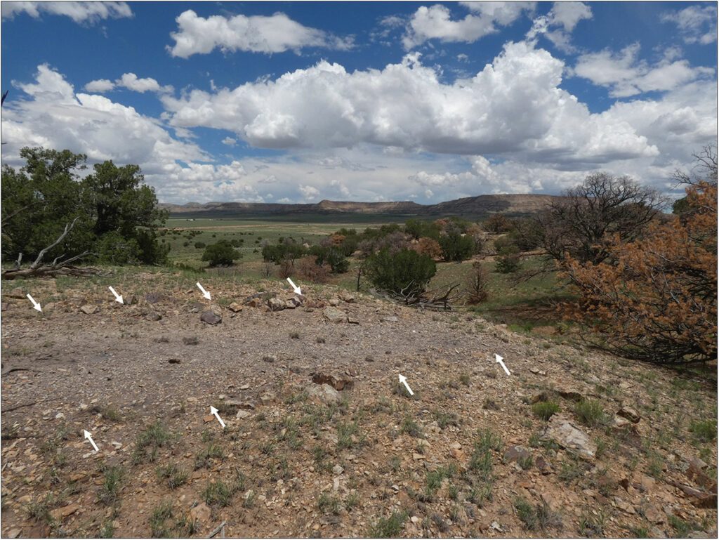
Road segment at the Gasco site, New Mexico
Robert S. Weiner
https://archaeology.org/news/2025/02/26/lidar-reveals-sacred-roads-near-chaco-canyon/
~ ~ ~
Lasers reveal 1,000-year-old Indigenous road near Chaco Canyon that aligns with the winter solstice
By Tom Metcalfe published February 19, 2025
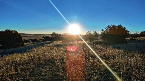
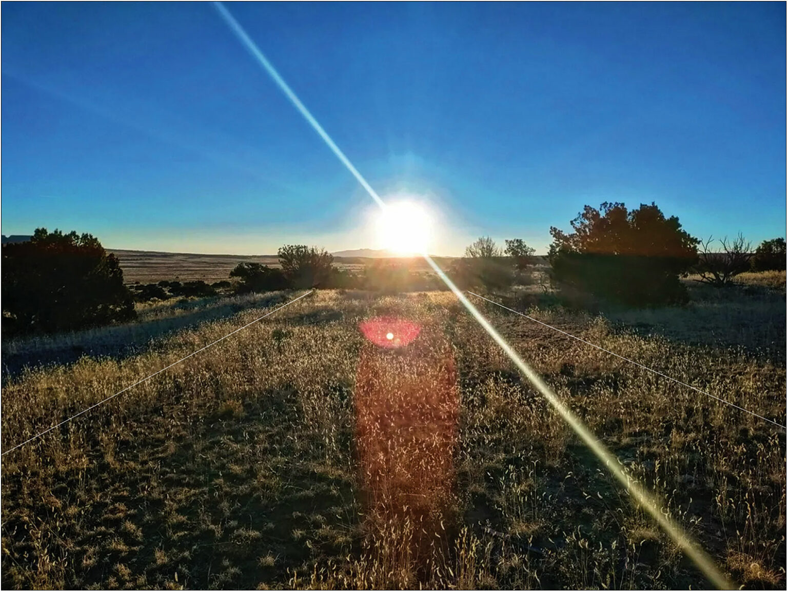
A sunrise over a grassy field with two white lines indicating a road drawn on the image
The winter solstice sunrise over Mount Taylor, seen from the center of the northern nearly-parallel road at the Gasco site, which is shown by the two white lines. (Image credit: Weiner et al. Antiquity Publications Ltd.)
Lasers have revealed a 1,000-year-old sacred road near Chaco Canyon in New Mexico. Researchers say the road was part of an Indigenous ritual landscape, serving as a path between natural springs and aligning with the sunrise on the winter solstice, a new study finds.
Until now, researchers thought the road at the Gasco site may have linked Indigenous settlements in the area. But new research shows that not only is a sacred road there much longer than they thought, it also has a previously unknown road running almost parallel to it. In addition, the two roads align with the winter solstice sunrise over Mount Taylor, which remains a sacred mountain among Indigenous peoples today, the researchers wrote in the study.
The discoveries at Gasco, west of Albuquerque and about 50 miles (80 kilometers) south of Chaco Canyon, indicate that the roads made by this Indigenous culture were not just for regular traffic but were integral to their system of cosmological beliefs, the researchers wrote.
Researchers think the Indigenous roads were more about cosmology than traffic.
"One of the really exciting things about the work we've been doing with Chacoan roads is that they're forcing us to reconceptualize what a road might be, what a road might mean," study lead author Robert Weiner, an archaeologist at Dartmouth College, told Live Science.
The researchers used public maps based on lidar — an analog of radar that uses laser pulses to reveal a landscape hidden beneath vegetation — to determine that the known road at the Gasco site was almost 4 miles (6 km) long, instead of the few hundred feet that had been found before. They then confirmed their new understandings of the site with fieldwork in 2021 and 2022, according to the study published Jan. 24 in the journal Antiquity.
More:
https://www.livescience.com/archaeology/lasers-reveal-1-000-year-old-indigenous-road-near-chaco-canyon-that-aligns-with-the-winter-solstice